
Mpendle topographic map
Interactive map
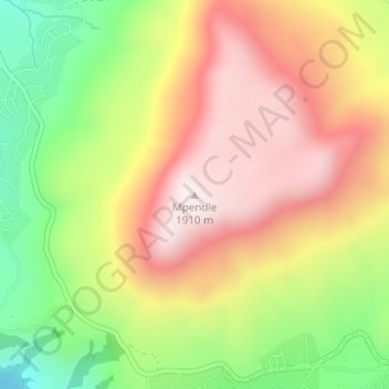
Click on the map to display elevation.
About this map
Name: Mpendle topographic map, elevation, terrain.
Average elevation: 5,223 ft
Minimum elevation: 4,026 ft
Maximum elevation: 6,280 ft
Other topographic maps
Click on a map to view its topography, its elevation and its terrain.
Lotheni
South Africa > KwaZulu-Natal > uMgungundlovu District Municipality > Impendle Local Municipality
Lotheni, Impendle Ward 1, Impendle Local Municipality, uMgungundlovu District Municipality, KwaZulu-Natal, South Africa
Average elevation: 5,226 ft
uMngeni
South Africa > KwaZulu-Natal > uMgungundlovu District Municipality > Impendle Local Municipality
uMngeni, Impendle Local Municipality, uMgungundlovu District Municipality, KwaZulu-Natal, South Africa
Average elevation: 6,099 ft