
Loranca de Tajuña topographic map
Interactive map
Click on the map to display elevation.
About this map
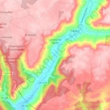
Name: Loranca de Tajuña topographic map, elevation, terrain.
Location: Loranca de Tajuña, Guadalajara, Castilië-La Mancha, Spanje (40.40506 -3.15602 40.47308 -3.07018)
Average elevation: 2,661 ft
Minimum elevation: 2,133 ft
Maximum elevation: 2,940 ft