
Kaxholmen topographic map
Interactive map
Click on the map to display elevation.
About this map
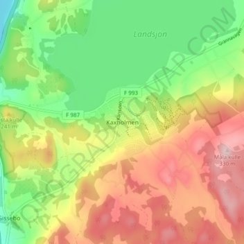
Name: Kaxholmen topographic map, elevation, terrain.
Location: Kaxholmen, Jönköpings kommun, Jönköping County, 56146, Sweden (57.83400 14.28759 57.87400 14.32759)
Average elevation: 656 ft
Minimum elevation: 282 ft
Maximum elevation: 1,083 ft