
Thank you for supporting this site ❤️
Make a donation
Make a donation
Gear up for your next adventure:
As an Amazon Associate, this site earns from qualifying purchases at no extra cost to you.
Cumbel topographic map
Click on the map to display elevation.
Thank you for supporting this site ❤️
Make a donation
Make a donation
Gear up for your next adventure:
As an Amazon Associate, this site earns from qualifying purchases at no extra cost to you.
About this map
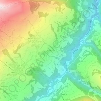
Name: Cumbel topographic map, elevation, terrain.
Location: Cumbel, Lumnezia, Surselva, Grisons, 7142, Switzerland (46.70518 9.17117 46.74518 9.21117)
Average elevation: 3,960 ft
Minimum elevation: 2,451 ft
Maximum elevation: 6,594 ft
Thank you for supporting this site ❤️
Make a donation
Make a donation
Gear up for your next adventure:
As an Amazon Associate, this site earns from qualifying purchases at no extra cost to you.