
Make a donation
Gear up for your next adventure:
As an Amazon Associate, this site earns from qualifying purchases at no extra cost to you.
Albulapass topographic map
Click on the map to display elevation.
Make a donation
Gear up for your next adventure:
As an Amazon Associate, this site earns from qualifying purchases at no extra cost to you.
Albulapass
The Albula Pass is an important axis from central Graubünden to Engadin. It is traversed by a paved road from Thusis to La Punt, via Bergün. It is also traversed by the Albula Railway, although at a lower elevation through the Albula Tunnel (1,820 m), from Thusis to Bever, also via Bergün.
Make a donation
Gear up for your next adventure:
As an Amazon Associate, this site earns from qualifying purchases at no extra cost to you.
About this map
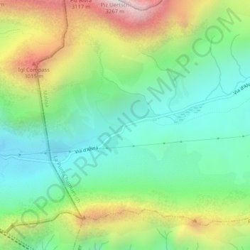
Name: Albulapass topographic map, elevation, terrain.
Average elevation: 8,399 ft
Minimum elevation: 7,224 ft
Maximum elevation: 10,591 ft
Make a donation
Gear up for your next adventure:
As an Amazon Associate, this site earns from qualifying purchases at no extra cost to you.