
Gerolfing Nord topographic map
Interactive map
Click on the map to display elevation.
About this map
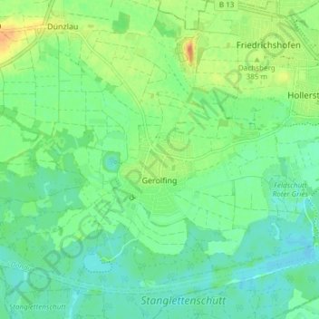
Name: Gerolfing Nord topographic map, elevation, terrain.
Location: Gerolfing Nord, West, Ingolstadt, Bavaria, 85049, Germany (48.73922 11.30451 48.77532 11.37941)
Average elevation: 1,227 ft
Minimum elevation: 1,184 ft
Maximum elevation: 1,302 ft
Other topographic maps
Click on a map to view its topography, its elevation and its terrain.