
Thank you for supporting this site ❤️
Make a donation
Make a donation
Gear up for your next adventure:
As an Amazon Associate, this site earns from qualifying purchases at no extra cost to you.
Tiawanacu topographic map
Click on the map to display elevation.
Thank you for supporting this site ❤️
Make a donation
Make a donation
Gear up for your next adventure:
As an Amazon Associate, this site earns from qualifying purchases at no extra cost to you.
About this map
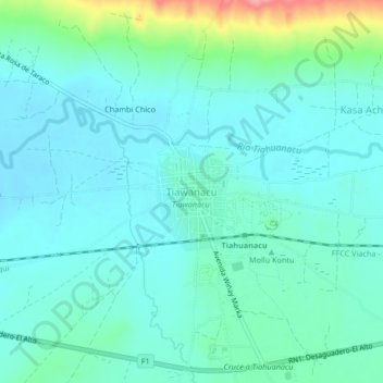
Name: Tiawanacu topographic map, elevation, terrain.
Location: Tiawanacu, Tiahuanacu, Ingavi, La Paz, Bolivia (-16.57312 -68.70160 -16.53312 -68.66160)
Average elevation: 12,635 ft
Minimum elevation: 12,559 ft
Maximum elevation: 12,946 ft
Thank you for supporting this site ❤️
Make a donation
Make a donation
Gear up for your next adventure:
As an Amazon Associate, this site earns from qualifying purchases at no extra cost to you.