
Taghzout topographic map
Interactive map
Click on the map to display elevation.
About this map
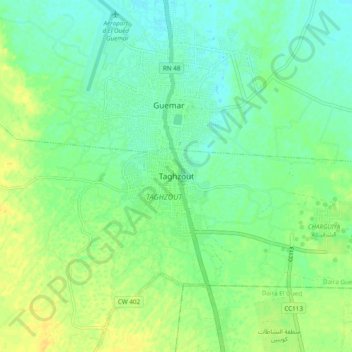
Name: Taghzout topographic map, elevation, terrain.
Location: Taghzout, Daïra Guemar, El Oued, 39002, Algérie (33.43548 6.75985 33.51548 6.83985)
Average elevation: 220 ft
Minimum elevation: 190 ft
Maximum elevation: 259 ft