
Јабланица topographic map
Interactive map
Click on the map to display elevation.
About this map
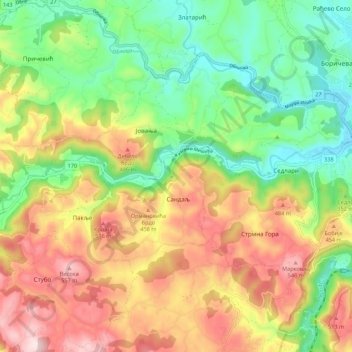
Name: Јабланица topographic map, elevation, terrain.
Average elevation: 1,201 ft
Minimum elevation: 636 ft
Maximum elevation: 1,919 ft
Other topographic maps
Click on a map to view its topography, its elevation and its terrain.
Valjevo
Serbia > Central Serbia > Valjevo
Valjevo, Valjevo City, Kolubara Administrative District, Central Serbia, 14000, Serbia
Average elevation: 1,325 ft