
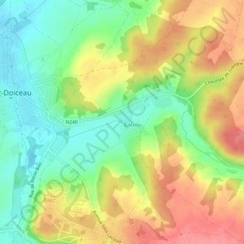
Le Piétrebais topographic map
Interactive map
Click on the map to display elevation.
About this map
Name: Le Piétrebais topographic map, elevation, terrain.
Average elevation: 266 ft
Minimum elevation: 141 ft
Maximum elevation: 400 ft
Other topographic maps
Click on a map to view its topography, its elevation and its terrain.
Le Piétrebais
Belgique > Wallonie > Grez-Doiceau
Le Piétrebais, Grez-Doiceau, Nivelles, Brabant wallon, Wallonie, 1390, Belgique
Average elevation: 272 ft