
Mossburn topographic map
Interactive map
Click on the map to display elevation.
About this map
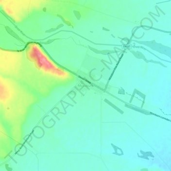
Name: Mossburn topographic map, elevation, terrain.
Average elevation: 981 ft
Minimum elevation: 906 ft
Maximum elevation: 1,211 ft
Other topographic maps
Click on a map to view its topography, its elevation and its terrain.
Lumsden
New Zealand > Southland > Southland District > Northern Community
Lumsden, Northern Community, Southland District, Southland, 9730, New Zealand
Average elevation: 725 ft