
Tébessa topographic map
Interactive map
Click on the map to display elevation.
About this map
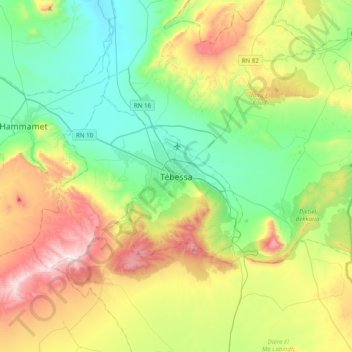
Name: Tébessa topographic map, elevation, terrain.
Location: Tébessa, daïra Tébessa, Tébessa, 12000, Algérie (35.24360 7.96123 35.56360 8.28123)
Average elevation: 3,497 ft
Minimum elevation: 2,441 ft
Maximum elevation: 5,610 ft