
Tekax topographic map
Interactive map
Click on the map to display elevation.
About this map
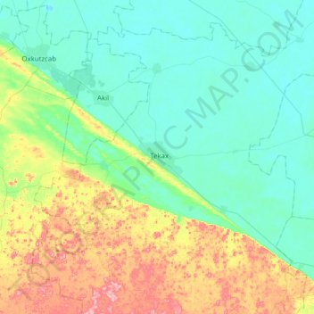
Name: Tekax topographic map, elevation, terrain.
Location: Tekax, Yucatán, 97970, México (20.04336 -89.44810 20.36336 -89.12810)
Average elevation: 197 ft
Minimum elevation: 56 ft
Maximum elevation: 581 ft