
Finchampstead topographic map
Interactive map
Click on the map to display elevation.
About this map
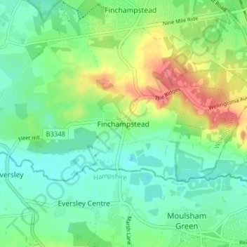
Name: Finchampstead topographic map, elevation, terrain.
Average elevation: 213 ft
Minimum elevation: 144 ft
Maximum elevation: 348 ft
Other topographic maps
Click on a map to view its topography, its elevation and its terrain.
Finchampstead
United Kingdom > England > Finchampstead
Finchampstead, Wokingham, South East, England, RG40 4EE, United Kingdom
Average elevation: 220 ft
Colebrook Lake North
United Kingdom > England > Finchampstead
Colebrook Lake North, Finchampstead, Wokingham, South East England, England, United Kingdom
Average elevation: 217 ft