
Los Andes topographic map
Interactive map
Click on the map to display elevation.
About this map
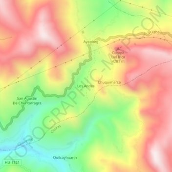
Name: Los Andes topographic map, elevation, terrain.
Location: Los Andes, Yarowilca, Huánuco, Peru (-9.89488 -76.57320 -9.85488 -76.53320)
Average elevation: 12,828 ft
Minimum elevation: 11,470 ft
Maximum elevation: 14,032 ft