
Haïdra topographic map
Interactive map
Click on the map to display elevation.
About this map
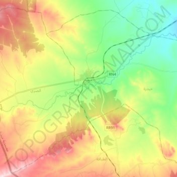
Name: Haïdra topographic map, elevation, terrain.
Location: Haïdra, Délégation Hidra, Gouvernorat Kasserine, Tunisie (35.49784 8.40634 35.61756 8.57104)
Average elevation: 2,900 ft
Minimum elevation: 2,418 ft
Maximum elevation: 3,570 ft