
Huambaló topographic map
Interactive map
Click on the map to display elevation.
About this map
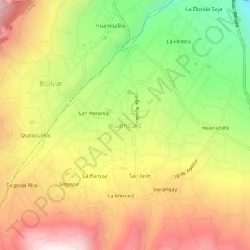
Name: Huambaló topographic map, elevation, terrain.
Location: Huambaló, San Pedro de Pelileo, Tungurahua, Équateur (-1.40822 -78.55138 -1.36822 -78.51138)
Average elevation: 9,396 ft
Minimum elevation: 7,723 ft
Maximum elevation: 10,945 ft