
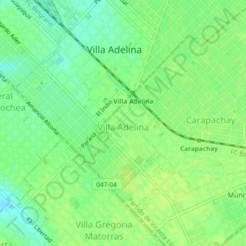
Villa Adelina topographic map
Interactive map
Click on the map to display elevation.
About this map
Name: Villa Adelina topographic map, elevation, terrain.
Average elevation: 82 ft
Minimum elevation: 52 ft
Maximum elevation: 98 ft
Other topographic maps
Click on a map to view its topography, its elevation and its terrain.
Olivos
Argentina > Buenos Aires > Vicente López
Olivos, Vicente López, Partido de Vicente López, Buenos Aires, Argentina
Average elevation: 56 ft
La Lucila
Argentina > Buenos Aires > Vicente López
La Lucila, Vicente López, Partido de Vicente López, Buenos Aires, Argentina
Average elevation: 49 ft
Florida
Argentina > Buenos Aires > Vicente López
Florida, Vicente López, Partido de Vicente López, Buenos Aires, Argentina
Average elevation: 75 ft
Plaza La Paz
Argentina > Buenos Aires > Vicente López
Plaza La Paz, Barrio Las Flores, Florida Oeste, Vicente López, Partido de Vicente López, Buenos Aires, Argentina
Average elevation: 85 ft