
Weißenhof topographic map
Interactive map
Click on the map to display elevation.
About this map
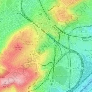
Name: Weißenhof topographic map, elevation, terrain.
Location: Weißenhof, Stuttgart-Nord, Stuttgart, Bade-Wurtemberg, Allemagne (48.79831 9.17337 48.81035 9.18545)
Average elevation: 1,001 ft
Minimum elevation: 748 ft
Maximum elevation: 1,335 ft
Other topographic maps
Click on a map to view its topography, its elevation and its terrain.
Stuttgart
Allemagne > Bade-Wurtemberg > Stuttgart
Stuttgart, Regierungsbezirk Stuttgart, Bade-Wurtemberg, 70173, Allemagne
Average elevation: 1,158 ft