
Vinto topographic map
Interactive map
Click on the map to display elevation.
About this map
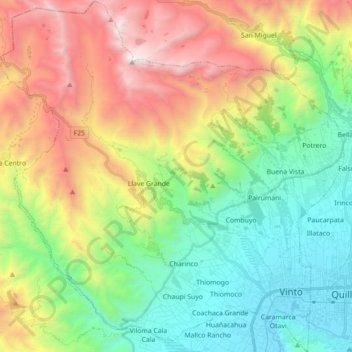
Name: Vinto topographic map, elevation, terrain.
Location: Vinto, Kanata, Quillacollo, Cochabamba, Bolivia (-17.42595 -66.45930 -17.25721 -66.28698)
Average elevation: 10,377 ft
Minimum elevation: 8,281 ft
Maximum elevation: 16,457 ft