
Damhal Hanjipora topographic map
Interactive map
Click on the map to display elevation.
About this map
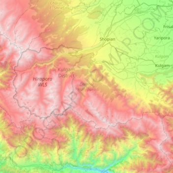
Name: Damhal Hanjipora topographic map, elevation, terrain.
Average elevation: 9,022 ft
Minimum elevation: 2,818 ft
Maximum elevation: 15,433 ft
Other topographic maps
Click on a map to view its topography, its elevation and its terrain.
Nehama
India > Jammu and Kashmir > Damhal Hanjipora
Nehama, Damhal Hanjipora, Kulgam District, Jammu and Kashmir, 192233, India
Average elevation: 6,434 ft