
Pantoja topographic map
Interactive map
Click on the map to display elevation.
About this map
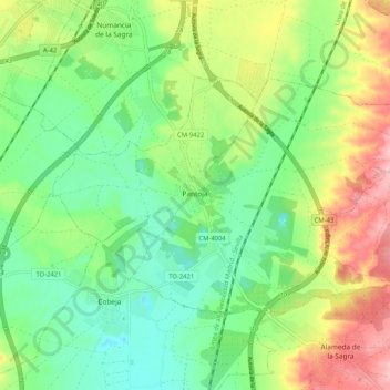
Name: Pantoja topographic map, elevation, terrain.
Location: Pantoja, La Sagra, Toledo, Castile-La Mancha, 45290, Spain (40.02087 -3.87315 40.06906 -3.76991)
Average elevation: 1,749 ft
Minimum elevation: 1,572 ft
Maximum elevation: 2,047 ft