
Marcigny topographic map
Interactive map
Click on the map to display elevation.
About this map
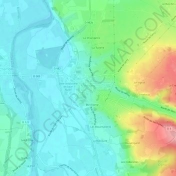
Name: Marcigny topographic map, elevation, terrain.
Average elevation: 902 ft
Minimum elevation: 781 ft
Maximum elevation: 1,227 ft
Other topographic maps
Click on a map to view its topography, its elevation and its terrain.
La Queue du Renard
Frankreich > Burgund und Freigrafschaft > Saône-et-Loire > Dyo
La Queue du Renard, Dyo, Charolles, Saône-et-Loire, Burgund und Freigrafschaft, Metropolitanes Frankreich, 71800, Frankreich
Average elevation: 1,299 ft
Dyo
Frankreich > Burgund und Freigrafschaft > Saône-et-Loire
Dyo, Charolles, Saône-et-Loire, Burgund und Freigrafschaft, Metropolitanes Frankreich, 71800, Frankreich
Average elevation: 1,191 ft