
San José topographic map
Interactive map
Click on the map to display elevation.
About this map
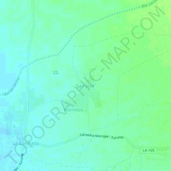
Name: San José topographic map, elevation, terrain.
Location: San José, Mórrope, Lambayeque, Perú (-6.49897 -80.00307 -6.45897 -79.96307)
Average elevation: 95 ft
Minimum elevation: 79 ft
Maximum elevation: 115 ft
Other topographic maps
Click on a map to view its topography, its elevation and its terrain.
Portada de Belén
Perú > Lambayeque > Mórrope
Portada de Belén, Mórrope, Lambayeque, Perú
Average elevation: 56 ft
Morrope
Perú > Lambayeque > Mórrope > Morrope
Morrope, Mórrope, Lambayeque, Perú
Average elevation: 62 ft