
兴州街道 topographic map
Interactive map
Click on the map to display elevation.
About this map
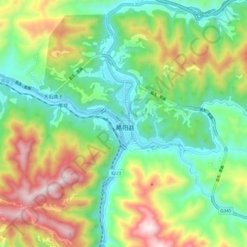
Name: 兴州街道 topographic map, elevation, terrain.
Location: 兴州街道, 略阳县, 汉中市, 陕西省, 中国 (33.29143 106.10848 33.37143 106.18848)
Average elevation: 3,114 ft
Minimum elevation: 2,060 ft
Maximum elevation: 5,000 ft