
Gura Ocniței topographic map
Interactive map
Click on the map to display elevation.
About this map
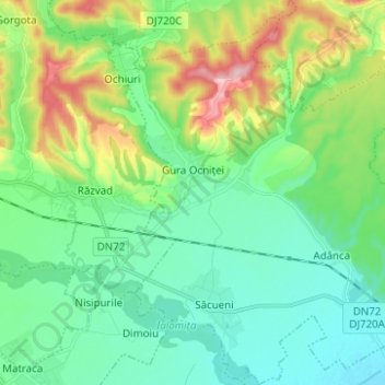
Name: Gura Ocniței topographic map, elevation, terrain.
Location: Gura Ocniței, Dâmbovița, Romania (44.89239 25.53775 44.98021 25.64630)
Average elevation: 896 ft
Minimum elevation: 715 ft
Maximum elevation: 1,381 ft
Other topographic maps
Click on a map to view its topography, its elevation and its terrain.