
Vila de Um Santo topographic map
Interactive map
Click on the map to display elevation.
About this map
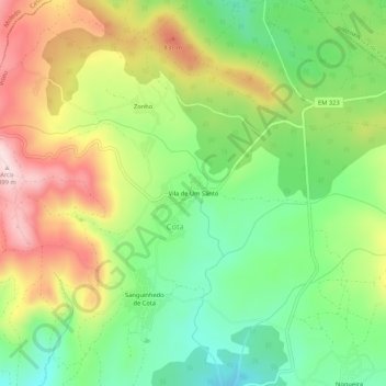
Name: Vila de Um Santo topographic map, elevation, terrain.
Location: Vila de Um Santo, Cota, Viseu, Portugal (40.78775 -7.83458 40.82775 -7.79458)
Average elevation: 2,339 ft
Minimum elevation: 1,890 ft
Maximum elevation: 2,936 ft
Other topographic maps
Click on a map to view its topography, its elevation and its terrain.
Sanguinhedo de Cota
Portugal > Viseu > Viseu > Cota
Sanguinhedo de Cota, Cota, Viseu, 3505-165, Portugal
Average elevation: 2,234 ft