Pic de l'Infern topographic map
Interactive map
Click on the map to display elevation.
About this map
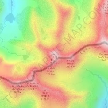
Name: Pic de l'Infern topographic map, elevation, terrain.
Average elevation: 8,461 ft
Minimum elevation: 7,339 ft
Maximum elevation: 9,436 ft

Click on the map to display elevation.
Name: Pic de l'Infern topographic map, elevation, terrain.
Average elevation: 8,461 ft
Minimum elevation: 7,339 ft
Maximum elevation: 9,436 ft