
Grimshaw Lake topographic map
Interactive map
Click on the map to display elevation.
About this map
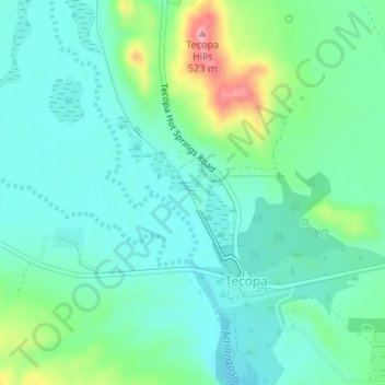
Name: Grimshaw Lake topographic map, elevation, terrain.
Average elevation: 1,394 ft
Minimum elevation: 1,293 ft
Maximum elevation: 1,703 ft
Other topographic maps
Click on a map to view its topography, its elevation and its terrain.
Tecopa
United States > California > CAL Fire San Bernardino Unit > Tecopa
Tecopa, CAL Fire San Bernardino Unit, CAL Fire Southern Region, California, United States
Average elevation: 1,667 ft