
向阳街道 topographic map
Interactive map
Click on the map to display elevation.
About this map
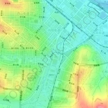
Name: 向阳街道 topographic map, elevation, terrain.
Location: 向阳街道, 鸡冠区, 鸡西市, 黑龙江省, 158100, 中国 (45.27475 130.96149 45.30461 130.98564)
Average elevation: 702 ft
Minimum elevation: 600 ft
Maximum elevation: 896 ft
Other topographic maps
Click on a map to view its topography, its elevation and its terrain.