
Bonbon topographic map
Interactive map
Click on the map to display elevation.
About this map
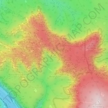
Name: Bonbon topographic map, elevation, terrain.
Average elevation: 1,115 ft
Minimum elevation: 387 ft
Maximum elevation: 1,778 ft
Other topographic maps
Click on a map to view its topography, its elevation and its terrain.
Bad Schandau
Allemagne > Saxe > Suisse-Saxonne-Monts-Métallifères-de-l'Est > Bad Schandau
Bad Schandau, Suisse-Saxonne-Monts-Métallifères-de-l'Est, Saxe, 01814, Allemagne
Average elevation: 988 ft