
Oued Taga topographic map
Interactive map
Click on the map to display elevation.
About this map
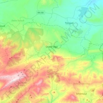
Name: Oued Taga topographic map, elevation, terrain.
Location: Oued Taga, Daïra de Teniet El Abed, Batna, Algérie (35.34359 6.21247 35.49547 6.54076)
Average elevation: 4,603 ft
Minimum elevation: 3,097 ft
Maximum elevation: 7,559 ft
Other topographic maps
Click on a map to view its topography, its elevation and its terrain.
Nouader
Algérie > Batna > Daïra de Teniet El Abed > Chir
Nouader, Chir, Daïra de Teniet El Abed, Batna, 05108, Algérie
Average elevation: 4,268 ft