
Gosau topographic map
Interactive map
Click on the map to display elevation.
About this map
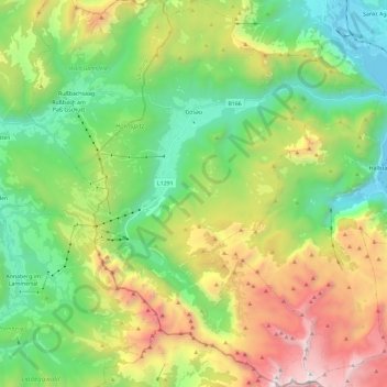
Name: Gosau topographic map, elevation, terrain.
Location: Gosau, Bezirk Gmunden, Upper Austria, 4824, Austria (47.47303 13.47537 47.63038 13.65163)
Average elevation: 4,383 ft
Minimum elevation: 1,647 ft
Maximum elevation: 9,514 ft
Gosau is situated along the Gosaubach stream in the Salzkammergut region. The center of the town is at an elevation of 767m (2,516'). 58.9% of the municipality is forested. At the southern end of Gosau there is a road leading to the Vorderer Gosausee, a lake with a view of the Dachstein.
Other topographic maps
Click on a map to view its topography, its elevation and its terrain.
Bad Ischl
Austria > Upper Austria > Bezirk Gmunden
Bad Ischl, Bezirk Gmunden, Upper Austria, 4820, Austria
Average elevation: 3,038 ft