
Cape St. Claire topographic map
Interactive map
Click on the map to display elevation.
About this map
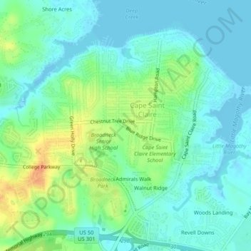
Name: Cape St. Claire topographic map, elevation, terrain.
Average elevation: 39 ft
Minimum elevation: -10 ft
Maximum elevation: 128 ft
Other topographic maps
Click on a map to view its topography, its elevation and its terrain.
Admirals Walk
United States > Maryland > Anne Arundel County > Cape Saint Claire
Admirals Walk, Cape Saint Claire, Anne Arundel County, Maryland, 21409, United States
Average elevation: 39 ft