
Wadakanchery topographic map
Interactive map
Click on the map to display elevation.
About this map
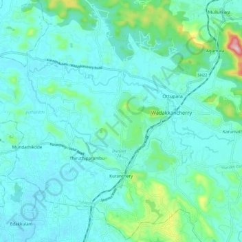
Name: Wadakanchery topographic map, elevation, terrain.
Location: Wadakanchery, Agamala, Talappilly, Thrissur, Kerala, India (10.61344 76.17705 10.69446 76.28153)
Average elevation: 177 ft
Minimum elevation: 10 ft
Maximum elevation: 1,109 ft