
Ixtlahuaca topographic map
Interactive map
Click on the map to display elevation.
About this map
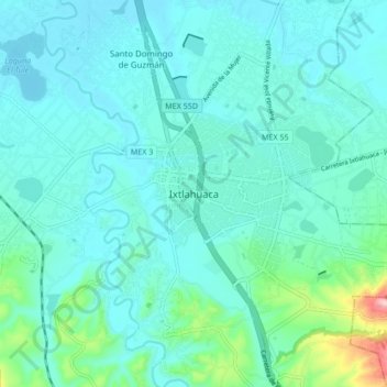
Name: Ixtlahuaca topographic map, elevation, terrain.
Location: Ixtlahuaca, Estado de México, 50740, México (19.52525 -99.80189 19.60525 -99.72189)
Average elevation: 8,383 ft
Minimum elevation: 8,268 ft
Maximum elevation: 9,052 ft
Other topographic maps
Click on a map to view its topography, its elevation and its terrain.
Ixtlahuaca de Rayon
México > Estado de México > Ixtlahuaca
Ixtlahuaca de Rayon, Ixtlahuaca, Estado de México, 50740, México
Average elevation: 8,360 ft