Geolocate

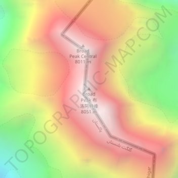
Broad Peak topographic map

Click on the map to display elevation.

Broad Peak

Broad Peak is one of the eight-thousanders, and is located in the Karakoram range spanning Gilgit-Baltistan, Pakistan and Xinjiang, China. It is the 12th highest mountain in the world at 8,051 metres (26,414 ft) elevation above sea level. The first ascent of this mountain was in June 1957, accomplished by Fritz Wintersteller, Marcus Schmuck, Kurt Diemberger, and Hermann Buhl as part of an Austrian expedition.

Wikipedia (CC-BY-SA 3.0)

About this map

Name: Broad Peak topographic map, elevation, terrain.

Location: Broad Peak, Dafdar, Taxkorgan Tajik Autonomous County, Kachgar, Xinjiang, China (35.81364 76.56551 35.81374 76.56561)

Average elevation: 23,350 ft

Minimum elevation: 19,226 ft

Maximum elevation: 26,345 ft

Gear up for your next adventure:

📻Weather Alert Radios - Stay informed of storm risks while off-the-grid
🕶️Glacier Sunglasses - Side shields to protect eyes from high-altitude snow glare
🔋Rechargeable Batteries - Power up your outdoor devices
❄️Traction Cleats - Prevent slips on icy trails during winter hikes
🛌Ultralight Sleeping Bags - Compact down bags for cold nights in the wilderness

As an Amazon Associate, this site earns from qualifying purchases at no extra cost to you.