
Le Haut Bois topographic map
Interactive map
Click on the map to display elevation.
About this map
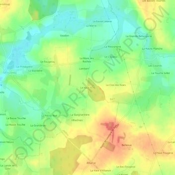
Name: Le Haut Bois topographic map, elevation, terrain.
Average elevation: 226 ft
Minimum elevation: 141 ft
Maximum elevation: 325 ft
Other topographic maps
Click on a map to view its topography, its elevation and its terrain.
Le Ballon
France > Bretagne > Ille-et-Vilaine > Moulins
Le Ballon, Moulins, Fougères-Vitré, Ille-et-Vilaine, Bretagne, France métropolitaine, 35680, France
Average elevation: 197 ft