
Thank you for supporting this site ❤️
Make a donation
Make a donation
Gear up for your next adventure:
As an Amazon Associate, this site earns from qualifying purchases at no extra cost to you.
Versailles topographic map
Click on the map to display elevation.
Thank you for supporting this site ❤️
Make a donation
Make a donation
Gear up for your next adventure:
As an Amazon Associate, this site earns from qualifying purchases at no extra cost to you.
About this map
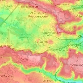
Name: Versailles topographic map, elevation, terrain.
Location: Versailles, Yvelines, Metropolitan France, 78000, France (48.76354 2.08669 48.84354 2.16669)
Average elevation: 469 ft
Minimum elevation: 269 ft
Maximum elevation: 607 ft
Thank you for supporting this site ❤️
Make a donation
Make a donation
Gear up for your next adventure:
As an Amazon Associate, this site earns from qualifying purchases at no extra cost to you.