
Mazaricos topographic map
Interactive map
Click on the map to display elevation.
About this map
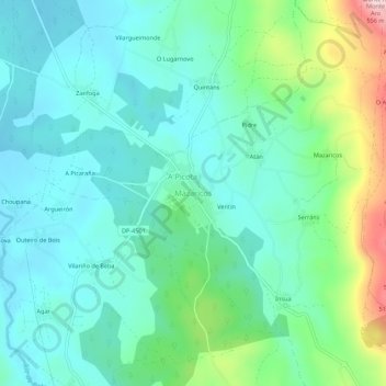
Name: Mazaricos topographic map, elevation, terrain.
Location: Mazaricos, Xallas, La Coruña, Galicia, 15258, España (42.91640 -9.01045 42.95640 -8.97045)
Average elevation: 1,079 ft
Minimum elevation: 850 ft
Maximum elevation: 1,811 ft