Geolocate

Lianjiang topographic map

Click on the map to display elevation.

About this map

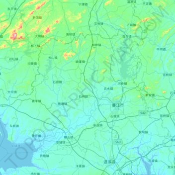
Name: Lianjiang topographic map, elevation, terrain.

Location: Lianjiang, Zhanjiang City, Guangdong Province, 524400, China (21.40469 109.73874 21.95812 110.50858)

Average elevation: 164 ft

Minimum elevation: -3 ft

Maximum elevation: 1,969 ft

Other topographic maps

Click on a map to view its topography, its elevation and its terrain.

Suicheng

China > Guangdong Province > Zhanjiang City

Average elevation: 69 ft

Gear up for your next adventure:

🧭Map Reading Tools - Tools and kits for map navigation
🗺️NatGeo Topo Maps - High-quality waterproof printed topographic maps of US Parks
🛡️Insect Repellent - Protection against bugs during outdoor activities
🪶Multi‑Purpose Knife - Useful blade for camp and trail
🪶Survival Guide Book - Expert advice for emergency preparedness

As an Amazon Associate, this site earns from qualifying purchases at no extra cost to you.