
Therwil topographic map
Interactive map
Click on the map to display elevation.
About this map
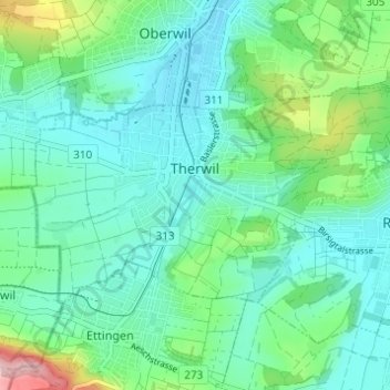
Name: Therwil topographic map, elevation, terrain.
Location: Therwil, Bezirk Arlesheim, Basel-Landschaft, 4106, Schweiz (47.48500 7.53178 47.50795 7.59291)
Average elevation: 1,119 ft
Minimum elevation: 974 ft
Maximum elevation: 1,621 ft