
Thank you for supporting this site ❤️
Make a donation
Make a donation
Gear up for your next adventure:
As an Amazon Associate, this site earns from qualifying purchases at no extra cost to you.
Bugalagrande topographic map
Click on the map to display elevation.
Thank you for supporting this site ❤️
Make a donation
Make a donation
Gear up for your next adventure:
As an Amazon Associate, this site earns from qualifying purchases at no extra cost to you.
About this map
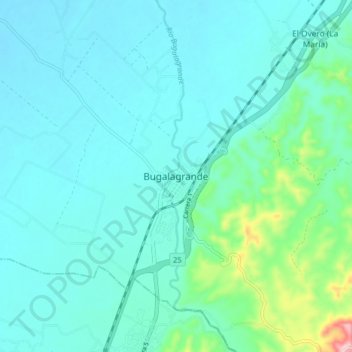
Name: Bugalagrande topographic map, elevation, terrain.
Location: Bugalagrande, Centro, Valle del Cauca, Colombie (4.17389 -76.19711 4.25389 -76.11711)
Average elevation: 3,153 ft
Minimum elevation: 3,012 ft
Maximum elevation: 3,957 ft
Thank you for supporting this site ❤️
Make a donation
Make a donation
Gear up for your next adventure:
As an Amazon Associate, this site earns from qualifying purchases at no extra cost to you.