
Thank you for supporting this site ❤️
Make a donation
Make a donation
Gear up for your next adventure:
As an Amazon Associate, this site earns from qualifying purchases at no extra cost to you.
Ampefy topographic map
Click on the map to display elevation.
Thank you for supporting this site ❤️
Make a donation
Make a donation
Gear up for your next adventure:
As an Amazon Associate, this site earns from qualifying purchases at no extra cost to you.
About this map
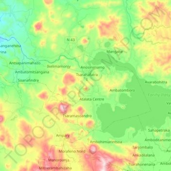
Name: Ampefy topographic map, elevation, terrain.
Location: Ampefy, Itasy, Province d’Antananarivo, Madagascar (-19.09657 46.63439 -19.00697 46.79357)
Average elevation: 4,242 ft
Minimum elevation: 3,412 ft
Maximum elevation: 5,659 ft
Thank you for supporting this site ❤️
Make a donation
Make a donation
Gear up for your next adventure:
As an Amazon Associate, this site earns from qualifying purchases at no extra cost to you.