
Titz topographic map
Interactive map
Click on the map to display elevation.
About this map
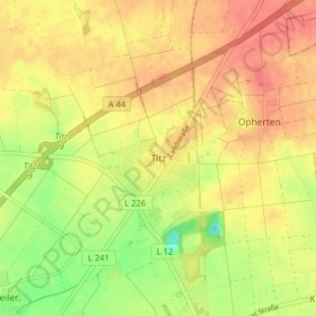
Name: Titz topographic map, elevation, terrain.
Location: Titz, Kreis Düren, Nordrhein-Westfalen, 52445, Deutschland (50.98752 6.40702 51.02752 6.44702)
Average elevation: 338 ft
Minimum elevation: 233 ft
Maximum elevation: 400 ft
Die Gemeinde Titz liegt in der Jülicher Börde. Im Süden befindet sich die Sophienhöhe. Östlich und nordöstlich der Gemeinde liegt der Braunkohletagebau Garzweiler.