
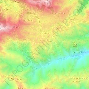
La Unión topographic map
Interactive map
Click on the map to display elevation.
About this map
Name: La Unión topographic map, elevation, terrain.
Average elevation: 3,504 ft
Minimum elevation: 2,461 ft
Maximum elevation: 4,619 ft
Other topographic maps
Click on a map to view its topography, its elevation and its terrain.
El Hatillo
Venezuela > Estado Miranda > Municipio El Hatillo > Caracas
El Hatillo, Caracas, Parroquia Santa Rosalía de Palermo, Municipio El Hatillo, Estado Miranda, 1083, Venezuela
Average elevation: 3,934 ft
Sector Cantarrana
Venezuela > Estado Miranda > Municipio El Hatillo > Caracas
Sector Cantarrana, Caracas, Parroquia El Hatillo, Municipio El Hatillo, Estado Miranda, 1083, Venezuela
Average elevation: 3,822 ft