
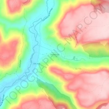
Tomellosa topographic map
Interactive map
Click on the map to display elevation.
About this map
Name: Tomellosa topographic map, elevation, terrain.
Average elevation: 2,890 ft
Minimum elevation: 2,415 ft
Maximum elevation: 3,310 ft
Other topographic maps
Click on a map to view its topography, its elevation and its terrain.
Malacuera
España > Castilla-La Mancha > Brihuega
Malacuera, Brihuega, Guadalajara, Castilla-La Mancha, 19214, España
Average elevation: 3,205 ft
Valdesaz
España > Castilla-La Mancha > Brihuega
Valdesaz, Brihuega, Guadalajara, Castilla-La Mancha, España
Average elevation: 3,186 ft
Olmeda del Extremo
España > Castilla-La Mancha > Brihuega
Olmeda del Extremo, Brihuega, Guadalajara, Castilla-La Mancha, España
Average elevation: 3,264 ft