
Make a donation
Gear up for your next adventure:
As an Amazon Associate, this site earns from qualifying purchases at no extra cost to you.
Kampung Janda Baik topographic map
Click on the map to display elevation.
Make a donation
Gear up for your next adventure:
As an Amazon Associate, this site earns from qualifying purchases at no extra cost to you.
Kampung Janda Baik
Before Janda Baik was founded in 1930, the area was primarily inhabited by Orang Asli tribes. The village was founded when some residents moved from Bentong to an area with a higher elevation due to the 1926 floods that affected Bentong and other low elevation areas. The earliest founders for this village are Haji Deris, Haji Kadir, and Haji Yasir, who built a hut and stayed in the area for almost a week before others start to populate the area. The village was originally given the name Kampung Tiga Haji to refer to the three early settlers.
Make a donation
Gear up for your next adventure:
As an Amazon Associate, this site earns from qualifying purchases at no extra cost to you.
About this map
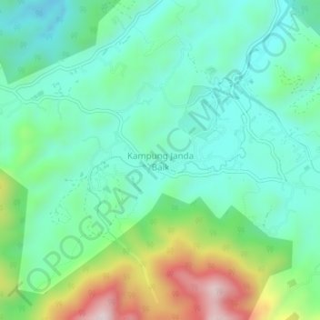
Name: Kampung Janda Baik topographic map, elevation, terrain.
Location: Kampung Janda Baik, Bentong, Pahang, 28750, Malaysia (3.30276 101.82868 3.34276 101.86868)
Average elevation: 1,644 ft
Minimum elevation: 1,152 ft
Maximum elevation: 2,936 ft
Make a donation
Gear up for your next adventure:
As an Amazon Associate, this site earns from qualifying purchases at no extra cost to you.