Geolocate

Jamestown topographic map

Click on the map to display elevation.

About this map

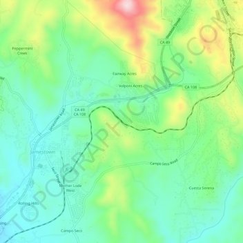
Name: Jamestown topographic map, elevation, terrain.

Location: Jamestown, Tuolumne County, California, United States (37.93672 -120.43436 37.98065 -120.37827)

Average elevation: 1,660 ft

Minimum elevation: 1,322 ft

Maximum elevation: 2,411 ft

Tuolumne County trails, hiking, mountain biking, running and outdoor activities

Gear up for your next adventure:

🧭GPS Watch Accessories - Bands and chargers for GPS watches
🦺Reflective Outdoor Gear - Safety gear for low‑light conditions
🧤Tactile Hiking Gloves - Keep hands warm while operating GPS and smartphone screens
🏔️Mountain Trail Maps - High‑detail maps for popular peaks
🕶️Glacier Sunglasses - Side shields to protect eyes from high-altitude snow glare

As an Amazon Associate, this site earns from qualifying purchases at no extra cost to you.