
Alvorada topographic map
Click on the map to display elevation.
About this map
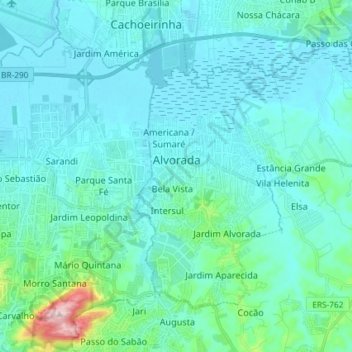
Name: Alvorada topographic map, elevation, terrain.
Average elevation: 118 ft
Minimum elevation: 0 ft
Maximum elevation: 1,014 ft
Other topographic maps
Click on a map to view its topography, its elevation and its terrain.
Porto Alegre
Brazil > Rio Grande do Sul > Metropolitan Region of Porto Alegre > Porto Alegre
Porto Alegre has a long coastline on the Guaíba Lake, and its topography is punctuated by 40 hills. In the lake, a vast body of water, a maze of islands facing the city creates an archipelago where a unique ecosystem gives shelter to abundant wildlife. The city area concentrates 28% of the native flora of Rio…
Average elevation: 89 ft
Estrada Carlos Dreyer
Brazil > Rio Grande do Sul > Metropolitan Region of Porto Alegre > Igrejinha
Average elevation: 2,041 ft